Seller Guide · by Aidan Sowa · 2026-10-07
How to Prepare Rockledge Stormwater and Floodplain Records
Connect drainage duties, map evidence and building approvals before comparing sale terms.
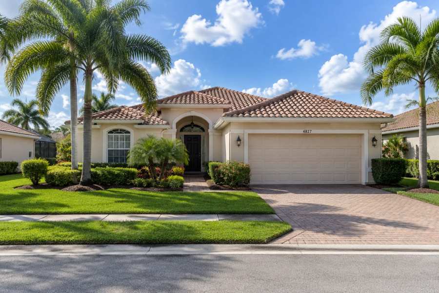
A Rockledge seller should connect stormwater and floodplain records to the actual property before calling a home free of water concerns or ready for improvements. A map, drainage system, association maintenance file and building permit each answer different questions. Heavy-rain ponding can matter even when a listing emphasizes distance from a river or the absence of a mapped high-hazard label.
The city's Residential Permit Requirements page describes fifty percent of building or structure market value as the substantial-improvement threshold and says assessed property value should not determine structure value. Another city page uses different valuation wording. This guide preserves that conflict, connects the correct records and avoids making a private flood determination, engineering finding or insurance quote.
Identify the Parcel and the Responsible Record Office
Identify the parcel, county and city-limit status before choosing floodplain or building instructions. A Rockledge postal address does not by itself determine the reviewing office. Preserve the legal description, parcel identifier and jurisdiction evidence, then connect each record request to the responsible authority. City and unincorporated county files should not be treated as interchangeable approvals for the same property.
Rockledge's Flood Zone Information page says its Building Division makes determinations for properties "within the City limits of Rockledge". Brevard County's Floodplain Administration page describes elevation-certificate retrieval for structures in unincorporated Brevard County. Those stated scopes help identify where to ask; neither source locates a private home for this guide.
The county page notes that older certificates require case-by-case research and may involve a recovery fee. An absent online result is not proof that an older home never had elevation documentation. Keep the search result, document request and any issued record separate from an assumption about construction history.
Jurisdiction file: Deed, parcel identifier, city-limit evidence, approved plat and office correspondence. For example, an owner with a Rockledge mailing address outside city limits should not claim the city approved an addition because a neighbor used its portal. This guide requested no private record and assigned no parcel to an office.
Keep Effective Maps and Local Flood Information Together
Preserve the effective flood map panel and date together with actual local flood information and any issued map-change document. A printed map can become stale, and an insurance layer does not describe every drainage problem. Keep source, purpose and date visible instead of treating a listing screenshot or map label as proof of safety, a permit decision or an insurance price.
FEMA's Flood Map Service Center calls itself "the official public source for flood hazard information" for the National Flood Insurance Program. It says downloaded effective information may change or be superseded. Save the actual effective panel and date instead of describing an old screenshot as permanently current.
Rockledge's Flood Zone Information page says the city has additional information, including "problems not shown on the FIRM", flood-depth data, historical flood information and natural floodplain functions. Its map service is therefore one part of a broader record inquiry. A FEMA layer should not erase local water-history evidence.
Map file: Effective panel, date, applicable zone, issued revisions, city information and actual property reports. A homeowner can preserve a local drainage complaint without turning it into a professional flood-zone finding. This guide selected no private zone, measured no flood depth and offered no insurance determination.
Preserve Ponding and Drainage History Beyond the Map
Keep observed ponding, drainage complaints and completed repair records separate from the mapped flood-zone label. Rockledge describes heavy-storm water accumulation as a local concern, and blocked conveyance can affect otherwise protected property. Record what actually happened, when it happened and what was changed. Do not describe a repaired drain or an unshaded map as a guarantee against future flooding.
The city's Flood Plain Management page says the primary threat is "ponding" during heavy storms and explains that street drainage and outfalls can be overwhelmed. It also describes debris clogging grates. These are public explanations of mechanisms, not a diagnosis of a seller's yard or proof that a specific street has an unresolved problem.
Rockledge's Drainage System Maintenance page explains that dumping, erosion, sedimentation and vegetation can reduce carrying or storage capacity. It asks residents to keep clippings and debris out of drainage systems and report localized problems. That instruction does not authorize a homeowner to excavate a ditch, alter an outfall or remove vegetation from a restricted area.
History file: Dated observations, reports, maintenance requests, repair scope, professional findings and completed approvals. A seller who recalls water near a garage during a hurricane should preserve the account and related work rather than use a broad no-flooding statement. No private damage history, drain capacity or engineering performance was assessed here.
Connect Neighborhood Stormwater Duties to the Permit Holder
Identify who operates the actual stormwater system and preserve its operation permit, plans and maintenance duties. An attractive neighborhood pond can be a treatment and storage facility rather than a natural water feature. City utility charges and association maintenance responsibilities are different parts of the record. Do not assume a pond is publicly maintained or that a paid fee proves required work was completed.
The St. Johns River Water Management District's stormwater-system article says residential system responsibility "typically is passed to a homeowners’ association (HOA) or property management company" after construction. It says operation and maintenance permits, plans and guidelines were transferred to the association and information can be obtained from the district. Typically is not proof of a particular association's ownership or duties.
The district's Permitting page provides its ePermit route to search permits and view staff reports. Its HOA Resources page provides background resources for communities. Use actual permit identifiers and documents rather than treating general educational material as a finding that a particular pond complies.
Rockledge's Stormwater Utility page describes charges based on equivalent residential units and impervious area, along with conveyance and water-quality functions. System file: Permit holder, operation permit, plans, inspections, maintenance records and association duties. This guide accessed no private association account and certified no system.
Keep Construction Approval and Elevation Evidence Distinct
Connect each floodplain project to issued construction approval, required inspection and elevation evidence. A permit is not proof that the work passed final review, and an elevation certificate is not permission for every future improvement. Preserve the actual documents and conditions. A sale does not convert a missing certificate or unfinished inspection into completed compliance simply because construction looks finished.
Rockledge's Development and Improvement Permits page says development in the floodplain requires a building permit. Its published flood FAQ explains that an elevation certificate after construction must be provided before the certificate of occupancy issues and that older submitted certificates can be reviewed at the Building Department. Keep these process stages separate.
FEMA's Elevation Certificate glossary explains that community permit files need elevation records for new buildings and substantial improvements in identified special flood hazard areas. The certificate records measured information relevant to floodplain management. It does not guarantee the home cannot flood or set the buyer's insurance premium.
Rockledge's Building Division page describes its current SmartGOV permit and inspection process. Construction file: Permit number, approved drawings, required conditions, field results, elevation certificate and final occupancy or completion document. A portal submission or booked inspection should stay labeled as such. This guide filed no permit or private inspection request.
Preserve the City Valuation Conflict Before Planning Work
Preserve the city's conflicting substantial-improvement valuation instructions and ask the responsible office to identify the current applicable rule. Structure value, assessed property value and land-inclusive sale price are not interchangeable figures. Keep project costs and the official determination visible. Do not choose whichever webpage makes the calculation look easier or present a seller's arithmetic as approval for proposed construction.
Rockledge's Residential Permit Requirements page uses "market value of the building or structure" and says assessed property value "shall not be used to determine the value of the structure". It notes that an independent appraisal may be required. Its Development and Improvement Permits page instead refers to assessed tax value and the assessed structure value listed by the property appraiser.
Those are materially different public instructions. This guide does not silently adopt one or calculate a private threshold. Keep both source titles visible and obtain the city's current rule and valuation basis for the actual project before committing to expansion or flood-damage restoration.
Brevard County's post-storm handout discusses market value, repair costs and community review, but a county handout does not settle the city webpage conflict. Valuation file: Complete work scope, estimates, accepted structure valuation, actual official decision and resulting requirements. No private value, repair total or substantial-improvement determination was calculated here.
| Record | What it supports | Cross-check | What it does not prove |
|---|---|---|---|
| Effective FEMA map | Current mapped hazard | Panel date and revisions | No future flooding |
| Local drainage history | Observed problems and work | Reports and professional findings | Engineering compliance |
| Operation permit | System holder and duties | Plans and maintenance | City construction approval |
| Elevation certificate | Measured building information | Datum and actual structure | Insurance price or all approvals |
| Official improvement determination | Accepted scope and valuation | Current city rule and conditions | Approval from webpage arithmetic |
Keep Permit Scope and Work Changes in the Handoff
Keep the detailed work scope, plans, revisions and final inspections together rather than presenting one permit as authorization for every site change. A pool, addition, drainage alteration and tree removal can have different review requirements. Preserve the actual route and unresolved questions. Do not use a generalized small-project label or a contractor statement to erase public construction and water-resource duties.
Rockledge's Residential Permit Requirements page says "All permit applications require a written and detailed narrative of the scope of work". It describes drawings and supporting records for different residential projects. A narrative should match actual completed or proposed work, not omit drainage changes merely because the visible project is a patio.
The district's Permitting page explains that its programs review requests affecting water resources. Preserve any applicable district permit or reviewing correspondence with city approvals. A city construction permit does not itself prove every district requirement was met, and a district system permit does not replace city construction review.
Scope file: Project description, plans, revisions, issued approvals, inspections and remaining conditions. For example, an owner with an approved addition and later grading changes should preserve both histories instead of claiming the first permit covers everything. The article reviewed public instructions, not a private project exemption or environmental compliance status.
Compare Sale Terms With Actual Records Rather Than Promises
Finish the packet with issued records and a separate list of unresolved questions. Keep pending map inquiries, missing maintenance evidence and open construction conditions visible. A direct purchase or listing can change the sale process but not the public record facts. Compare actual written terms without promising that a buyer's route removes flood risk, closes permits or releases the operator's stormwater duties.
Rockledge's Flood Plain Management page describes Community Rating System participation as a mechanism for reduced flood-insurance premiums. That community description is not a policy-specific discount or quote for the private home. Coverage, lender requirements and the actual premium remain matters for the relevant insurer and financing terms.
The district's stormwater-system article describes year-round storage and treatment duties and the need to maintain control structures. A sale does not turn those system responsibilities into optional landscaping. Keep the actual permit holder and maintenance terms visible rather than promising the buyer can change the pond or outfall at will.
Final packet: Jurisdiction, effective maps, local history, elevation evidence, system permits, maintenance duties, construction approvals, valuation questions and open conditions. A seller can hand over a clear record file while admitting a missing appraisal or unresolved inspection. No guaranteed approval, flood protection or private purchase outcome is offered.
Frequently Asked Questions
These questions reflect Rockledge building and drainage guidance, county record resources, district stormwater information and FEMA map documentation. They separate jurisdiction, risk, maintenance and approvals. They do not classify a private home or decide a valuation conflict. Use actual issued records and current office instructions when planning work, requesting missing documents or comparing written sale terms.
Does a Rockledge mailing address identify the reviewing office?
No, verify city limits and the actual jurisdiction. The city and unincorporated county record routes have different scopes.
Does an effective flood map describe every drainage problem?
No, the city says it has information about problems not shown on the FIRM. Preserve local history and professional findings separately.
Can heavy-rain ponding matter away from a river?
Yes, Rockledge describes ponding and overwhelmed street drainage as local mechanisms. A private diagnosis still needs actual property evidence.
Is a neighborhood pond always a natural water feature?
No, district guidance describes man-made stormwater ponds that store and treat runoff. Obtain the actual system plans and operation permit.
Does a city utility charge prove association maintenance is complete?
No, charges and maintenance evidence have different roles. Confirm the actual operator and required records.
Does an elevation certificate replace a permit?
No, it records measured building information. Construction approval and final inspection remain separate records.
Which city valuation wording should I use for substantial improvements?
The published city pages conflict on the valuation basis. Ask the responsible office for the applicable current rule before calculating or committing.
Does an old county elevation record miss mean no certificate exists?
No, county guidance says older records may need case-by-case research. Keep an absent search result separate from a conclusion about construction history.
Does a direct purchase cure an open floodplain permit?
No, sale terms do not replace public approvals. Preserve actual status and unresolved conditions.
How Maison Off-Market Fits a Stormwater Record Handoff
Maison Off-Market offers a direct-purchase route to compare after stormwater and floodplain records are organized. Its public process assesses the home and land and may lead to an offer if the property fits. That assessment is not drainage engineering, an elevation certificate or permit approval. Keep actual written sale terms separate from public requirements and unresolved maintenance or construction questions.
Maison Off-Market's current hosted site says "We assess the home and the land" and "If it fits" before describing an offer. These are process claims, not a private Rockledge valuation, flood determination or guarantee that an authority will approve a project. A direct purchase cannot resolve the city's valuation guidance conflict.
Compare written terms: The hosted site describes privacy without showings, no commissions or closing costs, and no seller repair work, with inspections and disclosures subject to applicable law and written terms. Preserve water history, system duties, maps and open permits when comparing a real proposal. No private insurance quote or guaranteed purchase is offered.
Compare your options before committing. Request a written private offer for your property, with no obligation, then weigh it against your listing plan.
Sources
- City of Rockledge, Checked October 2026. Development and Improvement Permits. https://www.cityofrockledge.org/187/Development-Improvement-Permits.
- City of Rockledge, Checked October 2026. Residential Permit Requirements. https://www.cityofrockledge.org/782/6282/Residential-Permit-Requirements.
- City of Rockledge, Checked October 2026. Building Division. https://www.cityofrockledge.org/142/Building-Division.
- City of Rockledge, Checked October 2026. Flood Frequently Asked Questions. https://www.cityofrockledge.org/FAQ.aspx?QID=76.
- City of Rockledge, Checked October 2026. Flood Plain Management. https://www.cityofrockledge.org/183/Flood-Plain-Management.
- City of Rockledge, Checked October 2026. Drainage System Maintenance. https://www.cityofrockledge.org/188/Drainage-System-Maintenance.
- City of Rockledge, Checked October 2026. Stormwater Utility. https://cityofrockledge.org/272/Stormwater-Division.
- City of Rockledge, Checked October 2026. Flood Zone Information. https://www.cityofrockledge.org/595/Flood-Zone-Information.
- Brevard County, Checked October 2026. Floodplain Administration. https://www.brevardfl.gov/PublicWorks/EngineeringProgram/FloodZoneInformation.
- Brevard County, Checked October 2026. Post-storm Inspection and Permitting. https://www.brevardfl.gov/docs/default-source/public-works/brevard-county-flood-zone-post-storm-inspection-and-permitting-requirement.pdf?sfvrsn=58a2efe_2.
- St. Johns River Water Management District, Checked October 2026. Stormwater System Storage and Treatment. https://www.sjrwmd.com/hoa-resources/your-stormwater-system-stores-and-treats-runoff/.
- St. Johns River Water Management District, Checked October 2026. Permitting. https://www.sjrwmd.com/permitting/.
- St. Johns River Water Management District, Checked October 2026. HOA Resources. https://www.sjrwmd.com/hoa-resources/.
- FEMA, Checked October 2026. Flood Map Service Center. https://msc.fema.gov/portal/home.
- FEMA, Checked October 2026. Elevation Certificate. https://www.fema.gov/glossary/elevation-certificate.
- Maison Off-Market, Checked October 2026. Current Hosted Process. https://files.instinct.com/zp8jmzhzb6oc-luxury-off-market-buyer-website.
Related research
Seller Guide · 2026-10-09
How to Assemble South Naples Flood Map and Repair Sale Records
Match effective maps, elevation evidence and approved repair records before presenting a sale file.
Seller Guide · 2026-10-09
How to Prepare Newton Tree Permit and Protection Sale Records
Separate removal permits, exemptions, arborist assessments and replacement obligations before selling.

Seller Guide · 2026-10-09
How to Organize Sevierville Well and Spring Water Sale Records
Separate the water source, construction report, test results and service history before selling.