Seller Guide · by Aidan Sowa · 2026-10-07
How to Prepare Prospect Floodplain and Drainage Records
Match the parcel to its jurisdiction before comparing maps, permits and drainage duties.
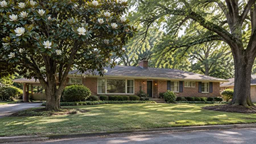
A Prospect seller should organize floodplain and drainage evidence before describing a home as outside flood risk or ready for new construction. The first question is jurisdiction: a Prospect mailing address does not identify every reviewing office, and the city itself spans Jefferson and Oldham counties. Effective maps, local review zones, elevation records, construction permits and recorded easements each answer different questions.
Kentucky's Division of Water explains that mapped A and AE zones have a one percent or greater annual chance of flooding. That is a recurring annual probability, not a promise that a flood happens only once each century. This guide connects the correct public rules to the records a seller can preserve without assigning a private flood zone, engineering a drainage solution or quoting insurance.
Start With the Parcel and the Reviewing Jurisdictions
Identify the legal parcel, county and whether it lies inside Prospect city limits before assembling permit instructions. A mailing address is not a jurisdiction decision. The city, county, state and a drainage authority can have separate roles. Preserve the deed, recorded plat and official parcel information, then ask the responsible offices which approvals apply to the actual property and proposed work.
Kentucky's Secretary of State Land Office entry lists Prospect in "Jefferson & Oldham" and answers "Yes" to whether it is in two counties. That official jurisdiction fact is a reason to avoid applying one county's checklist to every home with the same postal label. It does not place a private parcel inside a boundary.
The City of Prospect's Permits and Code Enforcement page describes city construction review and city permits. Oldham County's Floodplain Administrator page identifies its County Engineer's Office as responsible for floodplain management there. Louisville MSD's Development and Stormwater Permitting page describes its review of land disturbance in Jefferson County. Keep those scopes separate rather than calling them interchangeable city approvals.
Jurisdiction file: Deed description, parcel identifier, county, city-limit evidence, approved plat and written office guidance. An owner adding a pool on an Oldham County parcel should not borrow a Jefferson County erosion-control threshold as proof of exemption. This guide checked public agency guidance, not a parcel boundary or private permit requirement.
Keep Effective Flood Maps and Local Review Layers Separate
Preserve the effective map panel, date, flood zone and any actual map-change document before interpreting a property's mapped status. Local regulatory floodplains can differ from the FEMA insurance layer, and preliminary maps are a separate product. Record the map purpose and version instead of turning one screenshot into a conclusion about construction approval, insurance cost or all possible flooding.
Louisville MSD's Floodplain Maps page distinguishes the Jefferson FEMA annual-chance review zones, Jefferson Floodplain Ordinance review zones and combined-sewer floodprone area. Those are different layers with different purposes. A FEMA boundary alone therefore should not be described as the complete local development review boundary for a Jefferson County parcel.
FEMA's Flood Map Service Center calls itself "the official public source for flood hazard information" for the National Flood Insurance Program. It cautions that effective information downloaded or printed from the site may change or be superseded. Save the actual effective panel and date rather than relying on an undated listing image.
Kentucky's Find Your Flood Zone page says preliminary maps are "not for use in regulating the floodplains". They can help communicate changing risk, but they are not the same as effective maps. Map file: Panel number, effective date, applicable local layers, source date and issued letters of map change. This guide assigned no private zone or local review boundary.
Explain Annual Flood Chance Without Promising Safety
Explain mapped flood probability as an annual chance, not a countdown or a guarantee. Being outside a mapped high-hazard area does not mean a home cannot flood, and a map does not predict the depth of every future event. Keep public risk descriptions separate from an insurer's actual policy terms, a lender's requirements and property-specific drainage or elevation evidence.
Kentucky's Division of Water explains in Find Your Flood Zone that A and AE areas have a one percent or greater annual chance of flooding. It also states that low-risk zone X locations can still flood. A seller should not translate the older hundred-year terminology into a claim that a home is safe for the next several decades.
The Division's Understand Your Flood Hazards page states "Flooding can affect anyone." It describes flood insurance as a financial protection route in participating communities and points owners to insurance guidance. That public description is not an insurance premium for a Prospect home, a coverage guarantee or a prediction that a buyer's lender will waive coverage.
For example, a parcel may sit outside the effective FEMA high-hazard layer but have a history of water collecting near a basement stairwell. Keep the actual history and drainage records visible instead of using a map label to dismiss them. Risk file: Effective map, observed water events, repairs, professional reports and actual insurance information. No private loss history or policy was reviewed here.
Collect Elevation Evidence Without Treating It as a Permit
Collect the actual elevation certificate and related survey information when they exist, then connect them to the building, map version and vertical datum. An elevation record is not a blanket construction approval or a guarantee against flooding. Preserve the completed document, professional certification and relevant permit record rather than describing an old blank form or contractor estimate as measured evidence.
FEMA's Elevation Certificate glossary says a community permit file must contain an official record showing that new buildings and substantial improvements in identified special flood hazard areas are properly elevated. FEMA encourages use of its Elevation Certificate for that purpose. The document records relevant elevation information; it does not authorize every future project or replace the responsible community's review.
FEMA's Letter of Map Amendment and Letter of Map Revision-Based on Fill guidance distinguishes natural-ground and fill-based requests. It says requesters generally need survey or engineering information and often a licensed land surveyor or registered professional engineer to prepare elevation evidence. A seller's own measurement from a patio to a riverbank is not that professional record.
Elevation file: Building address, certificate date, certifier, datum, measured elevations, effective panel and any issued decision using that evidence. Keep a certificate attached to the structure it describes, especially when additions or grading occurred afterward. This guide measured no elevation, prepared no certificate and determined no home's compliance.
Connect Construction and Repair to the Correct Permit Scope
Connect each addition, deck, pool, grading project or floodplain repair to its actual approval route. City construction review, local floodplain review, state floodplain requirements and erosion-control permits are not the same permission. Preserve issued permits, approved plans, conditions and final inspection evidence. A sale does not turn missing approvals into completed work or make an older permit cover a new project.
Prospect's Permits and Code Enforcement page says "All new dwellings, additions, decks, garages, and pools require submission to the department." It describes a plot plan showing the house, lot, dimensions and easement together with construction plans. Apply this city guidance only after confirming the property's city jurisdiction and current project requirements.
Louisville MSD's Flood Permitting page says both Kentucky Division of Water and MSD permits are required to build, develop or repair in a floodplain. Its screening questions also address work in intermittent or perennial streams and within twenty-five feet from the top of bank. That screening detail is not a seller's engineering finding that a particular setback or permit is satisfied.
Oldham County's Floodplain Administrator page says "a local Oldham County permit is also required" in addition to state floodplain development permits. Kentucky's Understand Your Flood Hazards guidance distinguishes state general permits from individual permits and preserves local requirements. Permit file: Reviewing office, project scope, issued approval, plans, conditions, inspection results and unresolved correspondence. This guide filed or canceled no permit.
Keep Drainage Plans and Erosion Controls With the Work History
Preserve drainage and erosion-control records for the actual completed work instead of assuming a building permit covered surface-water changes. Grading, driveway work, retaining walls and pools can change where water goes. The responsible authority may review effects on neighboring or downstream property. Keep approved plans, construction changes, inspections and maintenance evidence together before making claims about a site's future capacity.
Louisville MSD's Development and Stormwater Permitting page describes review of drainage adjacent to and downstream of development, grading, easements, sewer service and erosion prevention. It specifically says the single-family, demolition or small-commercial permit is "for Erosion Prevention and Sediment Control only". That permit should not be presented as approval of every floodplain or drainage issue.
The same MSD page explains site-disturbance categories around two thousand square feet and one acre of disturbance. These are described permitting categories, not a rule that every project below a threshold needs no review. Project type, streams, floodplain location and other agencies can still matter. Use the actual approval path instead of selecting whichever number makes a project sound exempt.
Oldham County's Construction Permits and Inspections guidance calls for a site development plan providing for drainage and describes stormwater application requirements and a limited individual-lot exception. It says inspections and maintenance continue until its permit is terminated "in writing". Drainage file: Approved grades, drainage paths, erosion-control plan, inspections, revisions, maintenance and any written termination. No private drainage design was assessed.
Preserve Recorded Easements and Actual Encroachment Decisions
Keep recorded drainage or sewer easements, plats and maintenance agreements with the property file. A lawn, fence or patio occupying an easement does not prove the restriction was released. Distinguish an existing recorded instrument from a blank public form or pending request. Preserve any actual release or encroachment approval and ask the responsible authority how the proposed work affects its facilities.
Louisville MSD's Easements, Right-of-Way and Right-of-Way-Entry page provides forms for new sanitary sewer and drainage easements and release or encroachment plats. It describes submission, review and recording procedures for engineers, surveyors and developers. Those public forms are process resources, not evidence that a particular owner has permission to build over a facility.
MSD's posted Easement Release and Encroachment Procedures document is dated June two thousand fifteen. It says "the approval can be denied" if existing or possible future facilities lie within the easement. Use that document to understand the review distinction, while confirming current submission details with MSD; this guide does not adopt its old fee, staff names or processing time as current promises.
Oldham County Clerk's Land Records page explains access to recorded public documents through its indexing system. Retrieve actual property documents through the appropriate county record route rather than treating a listing diagram as the full title record. Recorded-rights file: Plat, easement instrument, amendments, maintenance duties and an issued release or encroachment agreement if one exists.
| Record | What it supports | Cross-check | What it does not establish |
|---|---|---|---|
| Effective FEMA map | Current mapped flood hazard | Panel date and map changes | Freedom from all flooding |
| Local review layers | Local development screening | Actual county and authority | Insurance price or private approval |
| Elevation certificate | Measured building information | Datum and building changes | Permission for every project |
| Issued permit and plans | Authorized work and conditions | Final inspections and actual scope | Approval for later additions |
| Recorded easement | Property-specific rights and limits | Amendments and issued release | Permission from a blank form |
Reconcile Map Changes and Open Records Before Comparing Offers
Finish the packet by separating issued decisions from requests still under review. A map amendment request, incomplete permit file or proposed easement release should remain clearly pending. Keep the effective map, actual letter, project approvals and unresolved water concerns visible. Comparing a direct purchase with a listing is easier when sale terms are not mixed with promises about future public approvals.
FEMA's map amendment guidance says an issued LOMA or LOMR-F can remove the federal flood-insurance purchase requirement in its stated financing context, but "the mortgage lender retains the prerogative to require flood insurance". It also says an issued letter does not mean the lot or structure is safe from all flooding. A pending application is not an issued letter.
Louisville MSD's Forms and Applications page lists floodplain permit and variance applications, minimum opening elevations, construction inspection reports and stormwater maintenance agreements. The list helps identify missing types of evidence. It does not show that a homeowner applied, received approval, completed inspection or obtained a maintenance release.
Final packet: Jurisdiction evidence, effective and local maps, elevation records, issued map decisions, permit history, drainage plans, recorded rights, inspection outcomes and open questions. For example, an owner with an issued map amendment and an unresolved drainage easement should preserve both instead of describing the property as cleared of all water restrictions. No private approval or sale outcome is guaranteed.
Frequently Asked Questions
These questions follow Kentucky flood guidance, Prospect construction review, Oldham County engineering resources, Louisville MSD permitting and FEMA map information. They separate jurisdiction, mapped risk, building evidence and recorded rights. They do not assign a private zone, certify drainage performance or quote insurance. Use current office instructions and the property's actual issued records for any project or unresolved question.
Does a Prospect mailing address identify every permit office?
No, the county and city-limit status must be checked for the actual parcel. The official state city entry lists Prospect in Jefferson and Oldham counties.
Does a hundred-year floodplain mean flooding happens once per century?
No, Kentucky describes A and AE zones as having a one percent or greater annual chance of flooding. The annual chance is not a schedule or guarantee.
Can a home outside the mapped high-hazard area still flood?
Yes, Kentucky guidance says low-risk areas can still experience flooding. Preserve actual water and drainage history rather than dismissing it with a map label.
Are preliminary maps the same as effective regulatory maps?
No, Kentucky says preliminary maps are not used to regulate floodplains. Save the effective panel and distinguish proposed information.
Does an elevation certificate replace a floodplain permit?
No, it records elevation information connected to the building. Required construction approvals remain a separate question for the responsible authority.
Does a state general permit remove local review?
No, Kentucky guidance preserves local floodplain permitting requirements. Confirm the applicable local route and the conditions of the state permit.
Does a small erosion-control permit approve every drainage issue?
No, MSD labels its single-family, demolition or small-commercial permit as erosion and sediment control only. Floodplain and other approvals can be separate.
Does a fence inside an easement prove permission?
No, the physical installation is not an issued release or encroachment agreement. Keep the recorded instrument and actual reviewing decision.
Does an issued map amendment guarantee no insurance requirement?
No, FEMA says the lender can still require flood insurance. An issued letter also does not mean the property is safe from all flooding.
How Maison Off-Market Fits a Floodplain Record Handoff
Maison Off-Market offers a direct-purchase route to compare after the floodplain and drainage file is organized. Its public process assesses the home and land and may produce an offer if the property fits. That assessment is not a flood map decision, drainage engineering report or public permit. Keep actual sale terms separate from unresolved records and continuing property duties.
Maison Off-Market's current hosted site says "We assess the home and the land" and "If it fits" before describing a direct offer. These are process descriptions, not a private Prospect valuation or proof that an authority will approve future grading. A direct purchase does not release a recorded drainage easement or replace local floodplain review.
Compare written terms: The hosted site describes privacy without showings, no commissions or closing costs, and no seller repair work, with buyer inspections and disclosures subject to applicable law and written terms. Preserve known water history, actual map decisions, approvals and recorded rights when comparing a real proposal. No insurance quote, permit guarantee or guaranteed purchase is offered here.
Compare your options before committing. Request a written private offer for your property, with no obligation, then weigh it against your listing plan.
Sources
- Kentucky Secretary of State, Checked October 2026. Prospect City Jurisdiction. https://web.sos.ky.gov/land/cities.aspx?CTR=329.
- City of Prospect, Checked October 2026. Permits and Code Enforcement. https://www.prospectky.gov/Blog/542/permits-and-code-enforcement.
- Kentucky Division of Water, Checked October 2026. Find Your Flood Zone. https://eec.ky.gov/Environmental-Protection/Water/FloodDrought/Pages/FindYourFloodZone.aspx.
- Kentucky Division of Water, Checked October 2026. Understand Your Flood Hazards. https://eec.ky.gov/Environmental-Protection/Water/FloodDrought/Pages/UnderstandYourFloodHazards.aspx.
- Oldham County, Checked October 2026. Floodplain Administrator. https://www.oldhamcountyky.gov/floodplainadministration.
- Oldham County, Checked October 2026. Construction Permits and Inspections. https://www.oldhamcountyky.gov/designguidance.
- Oldham County Clerk, Checked October 2026. Land Records. https://oldhamcountyclerk.ky.gov/land-records/.
- Louisville MSD, Checked October 2026. Flood Permitting. https://louisvillemsd.org/programs/floodplain-management/flood-permitting.
- Louisville MSD, Checked October 2026. Development and Stormwater Permitting. https://louisvillemsd.org/what-we-do/stormwaterdrainage/permitting.
- Louisville MSD, Checked October 2026. Floodplain Maps. https://louisvillemsd.org/floodplainmaps.
- Louisville MSD, Checked October 2026. Forms and Applications. https://louisvillemsd.org/what-we-do/stormwaterdrainage/permitting/forms.
- Louisville MSD, Checked October 2026. Easements, Right-of-Way and Right-of-Way-Entry. https://louisvillemsd.org/what-we-do/stormwaterdrainage/easements.
- Louisville MSD, Checked October 2026. Easement Release and Encroachment Procedures, June 2015. https://louisvillemsd.org/sites/default/files/inline-files/release%20encroachment%20procedures%20and%20review.pdf.
- FEMA, Checked October 2026. Flood Map Service Center. https://msc.fema.gov/portal/home.
- FEMA, Checked October 2026. Elevation Certificate. https://www.fema.gov/glossary/elevation-certificate.
- FEMA, Checked October 2026. LOMA and LOMR-F Guidance. https://www.fema.gov/flood-maps/change-your-flood-zone/loma-lomr-f.
- Maison Off-Market, Checked October 2026. Current Hosted Public Process. https://files.instinct.com/zp8jmzhzb6oc-luxury-off-market-buyer-website.
Related research
Seller Guide · 2026-10-09
How to Assemble South Naples Flood Map and Repair Sale Records
Match effective maps, elevation evidence and approved repair records before presenting a sale file.
Seller Guide · 2026-10-09
How to Prepare Newton Tree Permit and Protection Sale Records
Separate removal permits, exemptions, arborist assessments and replacement obligations before selling.

Seller Guide · 2026-10-09
How to Organize Sevierville Well and Spring Water Sale Records
Separate the water source, construction report, test results and service history before selling.