Seller Guide · by Aidan Sowa · October 6, 2026
How to Prepare Cornelius Built-Upon Area Records Before Selling
Separate recorded limits, existing hard surfaces and future expansion claims before comparing sale terms.
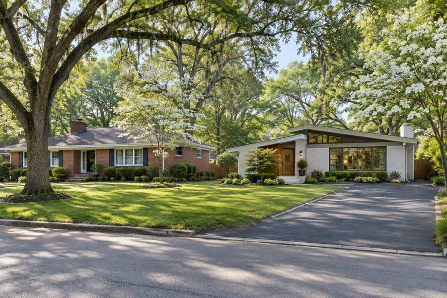
A broad lawn can make a Cornelius property look ready for a larger patio, a pool or an addition. The usable expansion question is more specific: which watershed rules apply, what built-upon area is allocated to the lot, and what surfaces already count against it? A seller should prepare those records before turning visible open space into a claim about what a buyer can build.
The Town of Cornelius FAQ asks directly about watersheds and impervious area, and its My Property guidance warns that added patios or walkways can create a compliance problem discovered during a sale survey. NC REALTORS' January 2025 question about discovery and disclosure of built-upon area shows the same concern from a transaction perspective. This guide organizes that evidence without measuring a private lot, finding an exemption or approving a future project.
Start With the Actual Parcel and Watershed Record
Use the legal address, parcel identifier and governing jurisdiction before applying a Cornelius rule. Confirm whether the lot lies in the Lake Norman or Mountain Island watershed and which requirements affect it. Preserve the source of that answer. A lake view, mailing address or general map is a lead, not a private determination of the lot allocation or its development rights.
Cornelius' My Property page explains how POLARIS can connect an address or parcel identifier to property information, deed references and the recorded plat. The page also says its information is provided as a courtesy and is not represented to be error free. Start there to locate the evidence, then preserve the actual deed and correct plat rather than relying only on a search result.
The Cornelius FAQ says most of the town lies within the Lake Norman or Mountain Island watersheds and points owners to its watershed and environmental-features map. North Carolina DEQ's Water Supply Watershed FAQ likewise directs owners to local government to determine whether the rules apply. Do not treat every Cornelius mailing address as having an identical restriction or assume only lakefront homes are affected.
Identity record: Keep parcel number, legal description, deed reference and plat book and page together. Note whether the property includes more than one parcel or a later subdivision. Use those identifiers when asking the Planning Department to clarify the applicable rule. A nearby property's allocation, especially one in another subdivision or watershed area, does not establish the limit for this lot.
Chapter Nine of the Town's current Environmental Protection code describes the official watershed map and gives watershed provisions precedence for density, open space and built-upon areas. The code index identifies a restructuring and a February 2026 amendment. This guide uses that framework; it has not confirmed a private boundary, reviewed a parcel-specific file or established that a particular home is exempt.
Recover the Recorded Allocation Before Calculating Headroom
A current hard-surface total and the amount allowed are different records. Recover the lot allocation from the applicable plat, development documents and official clarification before calculating unused area. Keep amendments and approved changes attached. A general percentage in a public overview should not replace a subdivision-specific limit, and a missing note should remain a question rather than become unlimited expansion capacity.
Cornelius' My Property guidance says the amount of built-upon area allocated to a property depends on factors including development density, proximity to the lake and applicable regulation. For subdivision lots, it says the developer sets restrictions during the development process. Recover that recorded allocation instead of multiplying lot acreage by a familiar percentage and marketing the result as approved capacity.
The Town's guidance outlines new-development density and cover options, but those project categories are not a ready-made calculation for every existing house. A seller may have a lot-specific limit, a different approved project framework or an applicable exemption. Ask the Town about that actual history and retain the answer. This guide deliberately does not assign one universal percentage to Cornelius homes.
Allocation file: Include the recorded plat, relevant notes or lot table, applicable approval and any later amendment. Preserve both the document and its explanation, including units and the area being measured. If a table refers to a subdivision lot number, match it to the current deed and parcel. Do not use the total area of an unrelated tract or include land the applicable calculation excludes.
The Town recommends reviewing watershed and impervious notes on the plat and checking with Planning when the information is incomplete. That is important when a seller has only an old survey or a title packet without the underlying approval. State what was recovered and what remains unverified. A missing allocation in an online search does not prove no allocation exists.
Inventory Roofs Driveways Patios and Other Counted Surfaces
Create a surface inventory that separates measured area, material and document source. Include the house, roofed features, driveway, walkways, patios and other relevant improvements. Keep the water surface of a pool separate from its deck. Do not classify every gravel or permeable-looking surface as exempt, and do not represent an aerial estimate as an approved survey of current conditions.
Cornelius' My Property page describes built-upon area as impervious and partially impervious cover, including buildings, pavement, gravel and recreational facilities. Its list excludes wooden slatted decks and the water area of a swimming pool. Those distinctions explain why a pool proposal can still use counted area through its surrounding deck, associated structures or other hard surfaces even when the water itself is not counted.
Charlotte-Mecklenburg's Built-Upon Area Materials sheet lists roofing, asphalt or concrete, brick and buildings among counted materials. It distinguishes qualifying number fifty-seven stone installed to its specified thickness over geotextile fabric from ordinary gravel. Keep evidence of the actual material and installation instead of calling every stone driveway pervious. The official sheet says its information is not all inclusive.
Surface schedule: Record each feature, its measured area where available, material, installation period if known and source of the measurement. Mark an estimate as an estimate. A covered deck may need different treatment from an open wooden slatted deck. Preserve the roofed portion distinctly so an appealing description such as outdoor living space does not hide the feature that affects the calculation.
Mecklenburg County GIS says impervious surfaces are identified and measured through aerial photography and directs owners to GeoPortal for their property's mapped area. The County also updates mapping through several sources, including completed permits. Use this as a comparison lead, not a certification that every recent improvement is captured or that every mapped surface receives the same treatment under the property's applicable regulation.
Keep Buffers Setbacks and Covenants Separate From Area Limits
Unused built-upon area does not establish where a new feature may be placed. Preserve the shoreline or stream buffer, building setbacks, easements and private restrictions as separate constraints. A buyer may have enough area on paper while the proposed location conflicts with another requirement. Keep those questions visible rather than describing a broad yard as an approved building envelope.
Cornelius' My Property page states, "All lakefront properties will have an undisturbed buffer requirement." It warns that the buffer can differ by neighborhood and sometimes by lot, and recommends checking the recorded plat first. Do not substitute a standard width from another neighborhood for the actual record. The Town's Environmental Protection chapter contains separate watershed and stream-buffer provisions that need to be read for the actual site.
The same property page directs owners to the plat for setbacks and to Planning when those are absent. It explains that the lakefront rear setback is the undisturbed buffer or its stated rear-property-line distance, whichever is greater. Preserve the actual applicable answer rather than calculating a buildable rectangle from a listing photograph. This guide does not locate a shoreline contour or stake a buffer.
Constraint overlay: Keep the survey, recorded buffer, setbacks and relevant easements with the allocation file. Ask the appropriate professional to show how a proposed feature relates to them. Label the proposal as conceptual until the applicable review is complete. An unused portion of the area allowance does not erase a recorded drainage easement or authorize construction within a protected buffer.
Cornelius' guidance also explains that neighborhood covenants may be more restrictive than Town code and that their enforcement is a private association matter. Recover the actual covenants and any existing approval instead of assuming Town review settles the HOA question. Keep Duke Energy shoreline permissions separate where the proposal involves lake structures; an upland surface calculation is not a dock or shoreline authorization.
Trace Added Surfaces Through Permits Surveys and Completion Records
Match later hard-surface improvements to their actual approval and completion evidence. Separate Town zoning review, County building permits, applicable surveys and issued closeout records. A feature that did not need a building permit can still affect the area limit. Preserve known changes since the last survey so the buyer does not mistake an earlier compliant condition for a complete current inventory.
The Cornelius FAQ says building permits go through Mecklenburg County, with Town zoning approval needed before the County can issue a permit. Preserve each stage within its role. A Town zoning approval is not the same as a final building inspection, and a County permit is not proof that every later patio or driveway extension appears in the watershed calculation.
Cornelius' My Property guidance says a new survey is required after new impervious area requiring a building permit, to demonstrate compliance before release of a Certificate of Compliance. Keep the applicable submitted survey and actual issued result. An application, contractor invoice or inspection request should not be substituted for the completion record the owner says exists.
The Town makes the separate point that owners remain responsible for built-upon-area compliance even when the activity does not require a building permit. It specifically identifies patios and walkways as improvements that may be added unknowingly beyond the restriction. Inventory those changes too. No-building-permit-needed is not the same statement as no-watershed-limit-applies.
Change log: Record what changed since the latest survey, including driveway widening, roof additions and hardscape replacement. Preserve dates only where supported and identify unknowns honestly. If the current condition and old calculation disagree, ask for an updated professional comparison and Town clarification. Do not declare a violation or a cure solely from photographs, a mapped estimate or an informal subtraction.
| Record | What it supports | What it does not prove alone |
|---|---|---|
| Deed and recorded plat | Parcel identity and recorded notes | Current surface compliance |
| Allocation or approval record | Applicable lot allowance | An approved future addition |
| Current survey and surface schedule | Documented existing condition | Every exemption applies |
| GIS impervious layer | Mapped comparison lead | A current regulatory certification |
| Buffer and setback record | Separate location constraints | Unrestricted use of spare area |
| Permit and closeout evidence | Authorized scope and completion stage | All later hardscape is included |
| Averaging certificate and recorded documents | Specific approved allocation change | Any new transfer will be approved |
Treat Exemptions and Permeable Credits as Evidence Questions
An exemption or surface credit needs the applicable rule and supporting facts, not a seller-created label. Preserve the Town determination and any approval conditions. Distinguish pre-existing surfaces, qualifying materials and engineered permeable systems. A lot size, older subdivision date or permeable product name may prompt research, but it should not become a guarantee that a buyer has unlimited expansion rights.
Cornelius' My Property page lists potential exemption factors and immediately warns that these are not a guarantee. It directs owners to confirm with Planning. The page also says area existing before the effective date of the applicable regulation receives different treatment. Recover the relevant date, rule and evidence rather than assuming an old house makes every later driveway, roof or patio exempt.
Historical evidence: Keep the applicable plat, approval history, dated survey and other reliable records showing the actual condition at the relevant time. A recent aerial image cannot establish when every counted surface was built. If a seller remembers a patio being original but lacks records, label the timing unconfirmed. The Town or appropriate adviser can determine which evidence supports the claimed treatment.
Charlotte-Mecklenburg's materials sheet explains that approved permeable pavement systems can partially reduce built-upon area when installed and maintained under its design manual. It requires review approval for the credit and says the towns, including Cornelius, require commercial or HOA maintenance for these systems. A product advertised as permeable is not the same as an approved credit attached to the lot.
Keep the approved design, construction evidence, credited calculation and maintenance arrangement together. Do not promise a buyer that replacing a driveway with pavers will automatically cure an overage or create enough capacity for a pool. The actual system, installation, maintenance and review matter. This guide does not design a stormwater control, establish a credit or price a compliance remedy.
Preserve an Approved Averaging File Without Promising a New Transfer
Built-upon-area averaging can change an allocation through a formal process, but it is not an automatic purchase of spare capacity. Preserve any existing certificate, participating-parcel documents and recorded restrictions. Keep a proposed new transfer clearly pending. Eligibility, watershed location, preservation and approval requirements remain separate from a buyer offering a higher price for hoped-for expansion.
The current Cornelius Environmental Protection chapter places built-upon-area averaging in Section Nine. It describes receiving and donating lots within the same watershed and jurisdiction, an averaging certificate, non-revocable easement, metes-and-bounds description and recorded plats. Its process includes Watershed Review Board approval. Use those actual documents to explain an existing transfer rather than treating an informal agreement as completed authority.
The code states, "Only the owner(s) of the participating parcels may submit a Built-Upon Area Averaging Certificate application." It also restricts participating locations and addresses parcels with watershed variances, preservation of donated land and applicable stormwater requirements. Do not promise that any nearby undeveloped parcel can supply area or that a transfer between different watershed areas will qualify.
Averaging packet: Preserve the issued certificate, approval conditions, final recorded plats, easement and affected-parcel descriptions. Keep the receiving lot and donated area identifiable. A draft plat or paid application fee does not establish issuance or recording. If the file is incomplete, identify the missing step instead of marketing the proposed higher allowance as an existing property attribute.
The Town's My Property overview still directs readers to older Chapter Eleven averaging numbering, while the code index announces restructuring and the current environmental chapter contains the substantive provisions. That difference is a reason to use the current code and ask Planning about the actual file, not a reason to invent a shortcut. No averaging application, fee payment, easement or private transfer has been arranged by this guide.
Explain Existing Capacity and Future Projects Separately in a Sale
A seller packet should distinguish the documented current condition from a buyer's proposed addition, pool or hardscape. Provide the relevant allocation, surveys, constraints and known gaps during the permitted review. Ask how unresolved matters affect the written offer. Neither an attractive price nor a direct purchase turns a conceptual expansion into an approved project or removes the applicable disclosure questions.
NC REALTORS' January 2025 discovery-and-disclosure guidance discusses built-upon-area restrictions as potentially material for vacant land and developed land intended for redevelopment. It recommends local planning or zoning consultation and a survey to evaluate conditions and proposed development. Use this as transaction guidance within that scope, not a substitute for the owner's actual disclosure duties or legal advice about a particular contract.
Description discipline: State the source and limits of any capacity claim. A recovered allocation and recent survey may support a defined comparison, but a planned pool introduces its own surface and location questions. Avoid room-for-anything language. A safer packet makes the calculation and unresolved approvals visible so the buyer and appropriate professionals can evaluate the real proposed scope.
Compare written proposals using the same relevant property evidence. Ask who handles remaining review, what conditions affect the timeline and how the documented limitations affect the terms. Do not invent a correction cost, contract provision or guaranteed closing date. A cash purchase may alter financing concerns, but it does not certify watershed compliance or approve a new footprint.
Update the packet when official clarification, a new survey or a recorded amendment changes the picture. Keep earlier versions so the difference is clear, and avoid publishing signatures or unrelated owner details in a public listing. The goal is a truthful handoff of current evidence, not a public archive of private records or a promise that every buyer will want the same project.
Frequently Asked Questions
These answers address recurring Cornelius watershed, impervious-area and expansion questions without determining a private lot. Confirm jurisdiction, recover the recorded allocation and compare current surfaces using the appropriate evidence. Keep exemptions, buffers, credits and averaging approvals separate, and obtain project-specific clarification before describing a pool, addition or new transfer as available or authorized.
Does a lake view establish the applicable watershed restriction?
No, confirm the parcel and governing watershed record. A view or mailing address is only a starting point.
Can every Cornelius lot use the same built-upon-area percentage?
No, the applicable framework and recorded lot allocation matter. Recover those records before calculating headroom.
Does the swimming pool water count the same as its deck?
The official materials guidance distinguishes pool water from surrounding hard surfaces. Inventory the deck and associated features separately.
Is every gravel driveway exempt from built-upon area?
No, ordinary gravel and specified qualifying installations receive different treatment. Preserve material and installation evidence before claiming an exclusion.
Does no building permit mean no area restriction?
No, the Town says owners remain responsible for area compliance even without a building permit. Include patios and walkways in the review.
Is the GIS map a current compliance certification?
No, it is a mapped comparison source. Use the applicable allocation and appropriate current-condition evidence.
Does an older subdivision automatically establish an exemption?
No, the Town labels its exemption examples as potential factors. Obtain clarification for the actual property history.
Can spare area authorize construction inside a buffer?
No, area and location constraints are separate. Review the applicable buffer, setbacks and other restrictions.
Is a proposed averaging transfer already usable capacity?
No, preserve the formal approval and recorded documents. Keep a new application or incomplete file clearly pending.
How Maison Off-Market Fits a Watershed Record Handoff
Maison Off-Market offers a direct-purchase route to compare with a listing after the property evidence is organized. Its public process includes assessing the home and land and making an offer if it fits. That process does not establish a built-upon-area exemption, approve an averaging transfer or guarantee that the buyer can build a pool, addition or larger driveway.
Maison Off-Market's public site describes buying luxury homes and estates directly from owners without showings, commissions, closing costs or seller repair work. Those are public service claims, not a private Cornelius proposal or a watershed determination. Review the actual offer and responsibilities rather than assuming a simpler sale route resolves the surface inventory or creates expansion rights.
Compare actual terms: Provide the relevant allocation, survey, permit and constraint records during the permitted review, with known gaps attached. Ask how unresolved conditions affect price, timing and remaining steps. The written proposal and appropriate advisers should guide the decision; this guide does not promise a purchase, compliance cure or approval for a future development plan.
Compare your options before committing. Request a written private offer for your property, with no obligation, then weigh it against your listing plan.
Sources
- Town of Cornelius, Checked October 2026. My Property. https://cornelius.org/residents/my_property/index.php.
- Town of Cornelius, Checked October 2026. Frequently Asked Questions. https://cornelius.org/residents/faqs/index.php.
- Town of Cornelius, Checked October 2026. Land Development Code Index. https://cornelius.org/government/departments/planning_/land_development_code.php.
- Town of Cornelius, Checked October 2026. Chapter Nine Environmental Protection. https://cms2.revize.com/revize/cornelius/Document%20Center/Government/Departments/Planning/LDC/CH%2009%20Environmental%20Protection.pdf.
- North Carolina DEQ, Checked October 2026. Water Supply Watershed FAQ. https://www.deq.nc.gov/about/divisions/energy-mineral-and-land-resources/stormwater/stormwater-program/water-supply-watershed-program/wsw-faq.
- Charlotte-Mecklenburg Storm Water Services, Checked October 2026. Built-Upon Area Materials. https://www.charlottenc.gov/files/sharedassets/city/v/1/growth-and-development/documents/dev-center-fees/pcso/bua-guidelines_20240913.pdf.
- Mecklenburg County GIS, Checked October 2026. Impervious Mapping. https://gis.mecknc.gov/Impervious-Mapping.
- NC REALTORS, Checked October 2026. Discovery and Disclosure of Built-Upon Area. https://www.ncrealtors.org/question/discovery-and-disclosure-of-built-upon-area/.
- Maison Off-Market, Checked October 2026. Direct Purchase Process. https://bulkscaler.com.
Related research
Seller Guide · 2026-10-09
How to Assemble South Naples Flood Map and Repair Sale Records
Match effective maps, elevation evidence and approved repair records before presenting a sale file.
Seller Guide · 2026-10-09
How to Prepare Newton Tree Permit and Protection Sale Records
Separate removal permits, exemptions, arborist assessments and replacement obligations before selling.
Seller Guide · 2026-10-09
How to Organize Sevierville Well and Spring Water Sale Records
Separate the water source, construction report, test results and service history before selling.