Seller Guide · by Aidan Sowa · 2026-10-07
How to Prepare Coral Ridge Seawall and Dock Permit Records
Connect each seawall, dock and boat lift to its city, county, state and federal records before comparing sale offers.
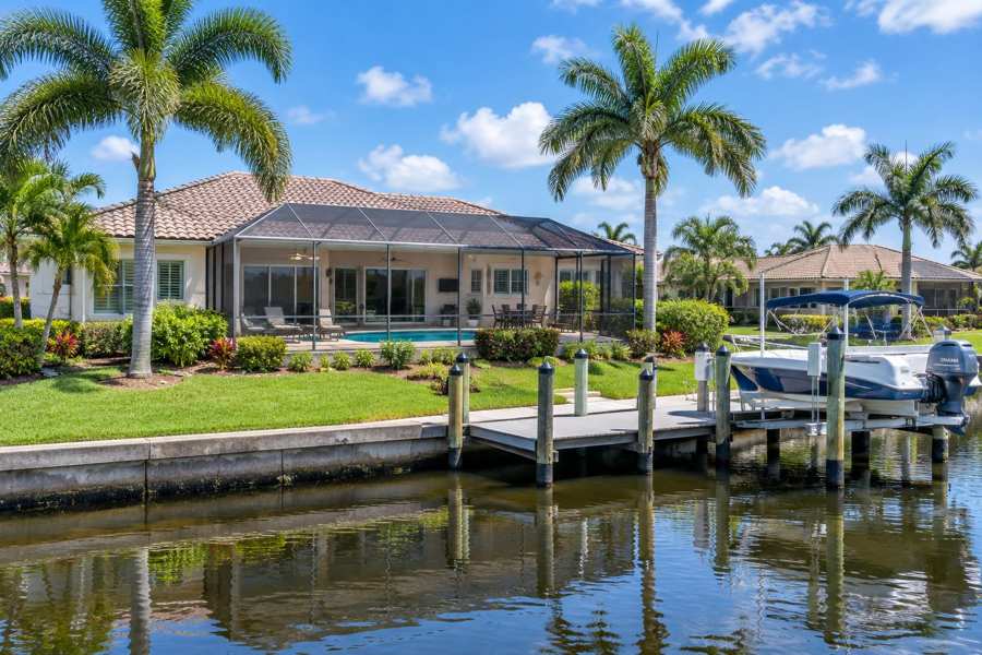
A Coral Ridge seller should connect every seawall, dock and boat lift record to the actual structure, the correct jurisdiction and the issued decision before promising repair, replacement or future expansion. A contractor proposal, an old county license and a neighborhood mailing address answer different questions. Keep federal verifications and state exemptions in the packet alongside city and county permits so the buyer sees the complete record.
Fort Lauderdale's Unified Land Development Regulations set the minimum top surface of a seawall at three point nine feet NAVD eighty-eight, and Broward County reports that in-water dock and seawall construction requires its Environmental Resource License. This guide organizes current public requirements and actual records, not a private structural assessment, repair authorization, permit approval or engineering finding.
Confirm the Governing Jurisdiction Before Assembling Records
Start with the actual property location and the agencies that regulate it. Coral Ridge is a Fort Lauderdale neighborhood, while Lauderdale-by-the-Sea is a separate incorporated town with its own building and floodplain processes. A postal address or marketing description does not establish which office issued a dock permit. Preserve the legal description, municipal boundary and issuing agency named on each record before choosing a permit route.
Coral Ridge parcels sit inside the City of Fort Lauderdale, so the City's Development Services Department, its Unified Land Development Regulations and its LauderBuild portal govern local dock and seawall permits. The City's LauderBuild page states that 'As of January 1, 2024, all permit applications and any related submissions must be done through LauderBuild'. Town parcels across the Intracoastal line follow the Town of Lauderdale-By-The-Sea's own forms instead.
Broward County regulates above both municipalities for in-water work. The County's Marine Facility Operating License page states that 'Any construction of docks, seawalls, installations of floating vessel platforms, or other structures constructed or installed in-water require an Environmental Resource License from Broward County.' A city permit does not replace the county license, and the county license does not replace the city permit.
Jurisdiction packet: Legal description, property appraiser record, municipal boundary evidence, the issuing agency named on each prior permit and the waterway classification. The Town's private-provider packet naming The Town of Lauderdale By The Sea as certificate holder is one visible sign of a separate permitting system. This guide mapped no parcel boundary and determined no jurisdiction for a particular property.
Map the Four Layers of Waterfront Permission
Waterfront work here can carry city, county, state and federal authorization at the same time. Keep each layer's instrument with the project record rather than treating one approval as covering all of them. The city permit addresses local code, the county license addresses in-water resource impacts, the state layer addresses submerged lands and environmental resources, and the federal layer addresses navigable waters.
The U.S. Army Corps of Engineers Jacksonville District explains that its State Programmatic General Permit 'SPGP VI authorizes 5 types of activities: Shoreline stabilization (e.g., seawalls or riprap); Boat ramps; Docks; Derelict vessel removal; and Scientific Devices.' When the state issues its authorization and the work fits the programmatic limits, the verification travels with it.
The Florida Department of Environmental Protection's federal coordination page describes agreements that let the state and partner agencies issue the federal verification alongside state authorization. Broward County appears among the implementing agencies for the current programmatic permit. Keep the verification instrument in the packet rather than assuming federal review happened.
Layer file: For each structure, list the city permit, county license, state exemption or permit and federal verification that actually exist. An absent layer is a fact to record, not a gap to paper over with a contractor's statement. No private structure was classified against these routes here.
| Route | Issuer | Typical trigger | Key recorded limit |
|---|---|---|---|
| City building permit | City of Fort Lauderdale through LauderBuild, or the Town of Lauderdale-By-The-Sea | Construction or repair of docks, seawalls and mooring structures | Digital submission through the city portal; town parcels use the town process |
| Environmental Resource General License | Broward County | Minor dock and seawall repair in listed categories | Dock repair not enlarged beyond five hundred square feet; seawall work no more than one foot waterward |
| Environmental Resource License | Broward County | Larger in-water work, dredging or wetland impacts | Full application with drawings, tidal elevations and a survey |
| State exemption or Environmental Resource Permit | Florida Department of Environmental Protection | Qualifying private docks and seawalls under section four hundred three | Docks of one thousand square feet or less in artificially created waterways; restoration within eighteen inches waterward |
| SPGP verification | U.S. Army Corps of Engineers with state agencies | Work matching programmatic activity types | Verification issued with the state authorization; no separate Corps application when it applies |
Use the Broward General License Categories for Minor Work
Broward County's technical bulletin on docks and seawalls lists which minor projects qualify for an Environmental Resource General License and which need a regular license. Keep the actual category with the repair record. Qualifying for the general track is a licensing route, not a finding that the existing structure was lawful when built or that future expansion is allowed.
The County's bulletin lists as eligible 'The repair or replacement of existing docks, provided the new or repaired dock is not enlarged beyond a total of five hundred (500) square feet over-water surface area for the new and existing structure.' It separately lists 'The repair, maintenance, or restoration of existing functional seawalls no more than one (1) foot water ward of their original authorized location.' Preserve the measured over-water area and the original authorized location rather than estimating from a photograph.
The same bulletin warns that projects larger than the listed categories, or involving dredging or wetland impacts, require a regular Environmental Resource License. Its application checklist calls for a vicinity map, plan and cross-section drawings of existing and proposed conditions, mean high and low water elevations in a tidal canal, a site survey and the licensing fee through the ePermits portal.
Category file: The license number, issued plans, the category claimed, measurements supporting it and final inspection or closure records. A general license describes the authorized work at issuance; it does not certify today's structural condition.
Anchor the Seawall to Fort Lauderdale's Current Elevation Standard
Fort Lauderdale ties seawall construction to a fixed elevation standard and a substantial-repair trigger. The current standard sets a minimum top elevation and caps the top at the base flood elevation on the applicable flood map. Preserve the survey elevations used at permitting and the trigger analysis for any repair rather than describing a wall as up to code without the record.
The City's Unified Land Development Regulations provide that 'The top surface of a seawall shall have a minimum elevation of 3.9 feet NAVD88' and that the elevation of a seawall or dock may not exceed the base flood elevation identified on the corresponding FEMA Flood Insurance Rate Map. Keep the datum, the surveyed top elevation and the map panel used with the permit record.
Ordinance C-16-27 amended Section 47-19.3 in two thousand sixteen to set elevation criteria and define when an improvement counts as a substantial repair. Later City amendments moved the seawall elevation language into the resilience standards of Section 47-19.13 and allow docks up to twelve inches above the associated tidal barrier or shoreline structure. Anchor claims to the current codified section rather than the older amendment summary.
Elevation file: Surveyed top-of-wall elevations with datum, the substantial-repair determination, the tidal barrier design where required and the issued permit. Lauderdale-by-the-Sea applies its own town standards, so do not carry the City figure across the municipal line.
Preserve State Exemption Boundaries Instead of Assuming Them
Florida law exempts some private docks and seawall work from state environmental permitting when the work stays inside measured boundaries. Keep the exact boundary that applied with the record. An exemption answers the state permitting question only; it does not remove county licensing, city permits or federal review, and it does not validate work that exceeded the boundary.
Section 403.813 of the two thousand twenty-five Florida Statutes exempts 'The construction of private docks of 1,000 square feet or less of over-water surface area and seawalls in artificially created waterways when such construction will not violate existing water quality standards, impede navigation, or affect flood control.' The statute limits vertical seawalls in estuaries and lagoons to manmade canals already occupied by vertical seawalls.
The same statute exempts 'The restoration of seawalls at their previous locations or upland of, or within 18 inches waterward of, their previous locations.' It also states this kind of exception 'does not constitute an exception from the permitting requirements of chapter 161.' Keep the measured distance from the previous location with the record, because the boundary is factual.
Exemption file: The waterway classification, measured over-water area, distance from the previous location, and any agency confirmation. Where the work exceeded a boundary, preserve what was actually built and which license covered it instead of relabeling it as exempt.
Connect the Federal Verification to Its State Trigger
Many qualifying dock and seawall projects never carry a separate U.S. Army Corps application because the federal verification travels with the state authorization under the programmatic permit. Preserve that verification where it exists. The absence of a standalone Corps permit number is not evidence that federal review was skipped when the programmatic route applied.
The Jacksonville District explains that the programmatic permit lets the Florida Department of Environmental Protection and other agencies issue the verification 'concurrently with their other State authorization(s), that the applicant's proposed work is authorized pursuant to the SPGP and that a separate application to the U.S. Army Corps of Engineers (Corps) is not required.'
The District lists the current instrument as SPGP VI-R1, effective August sixteenth, two thousand twenty-one, replacing the version effective July twenty-seventh, two thousand twenty-one. Its attachments include dock construction guidelines and manatee conditions for in-water work, which become part of the authorized project when they apply.
Verification file: The state or county authorization that carried the verification, any self-certification statement, and the conditions attached. Keep the instrument itself rather than a recollection that everything was handled.
Keep Flood and Elevation Records With the Waterfront Packet
Flood and elevation records belong with the waterfront packet, but they answer a building question rather than a seawall question. An elevation certificate documents floor elevations and flood zones for insurance and substantial-improvement review. Keep it alongside seawall and dock permits without treating it as evidence about the wall's condition or compliance.
The City of Fort Lauderdale's elevation certificate page states that 'Elevation certificates are required in the City of Fort Lauderdale for all new construction and substantial improvements, as well as for any additions being made to an existing structure.' The City notes that licensed surveyors, architects and engineers prepare the certificates and that submitted copies are retained on file.
The Town of Lauderdale-By-The-Sea's elevation certificate information explains the fifty-percent rule: 'if a structure is in a flood zone and is damaged or improved to more than 50% of its market value, it must be elevated to the current required height.' The Town adds that it does not vouch for the authentication of certificates and directs questions to the surveyor.
Flood file: Current elevation certificate, flood zone and map panel, any substantial-improvement determinations and finished-construction certificates. A certificate's date matters; preserve which version was current at each project.
Pull the Actual Permit History Instead of a Summary
Assemble the waterfront packet from issued records rather than recollection. Fort Lauderdale's LauderBuild portal holds permit records, plan-room documents and inspection results, and anyone can run a basic record search without an account. The Town of Lauderdale-By-The-Sea maintains its own permit files. Preserve the issued permit, approved plans and final inspections for each structure.
The City's LauderBuild page states that 'Anyone may perform a basic record search without creating an account, but certain information will only be available to the record owner.' Registered users can apply for permits, schedule inspections and follow correction requests, and plan-room access requires an account tied to the permit record.
The City's Development Services documents page publishes checklists and the Broward County Uniform Permit Application used for submissions. Keep the current form versions with the packet so a buyer can see which requirements were in force when each permit issued.
History file: Permit numbers, issued dates, approved plan sets, inspection outcomes, final or closed status and any open or expired records. An entered online application is not an issued permit; record the difference plainly.
Build a Sale Packet That Shows the Limits of Each Record
A useful Coral Ridge handoff connects each seawall, dock and lift to the authorizations that actually exist and states plainly what each record proves. Issued permits show what was authorized, inspections show what was observed, and exemptions show which boundary applied. None of them certifies current structural condition or guarantees a future permit. Preserve gaps as facts.
Organize the packet by structure: the seawall with its surveyed elevation and permit history, the dock with its measured over-water area and license category, and each lift or mooring device with its own authorization. Cross-reference the county license, city permit, state exemption and federal verification for each one.
Seller packet: Jurisdiction evidence, the layered authorization map, measured boundaries behind any exemption, elevation certificates, issued decisions and inspection results. Include unresolved items, such as an unpermitted repair or an open record, with their dates rather than summarizing them away.
For example, a seller may know a seawall was rebuilt after a storm but have only the county general license. Preserve that license, then record which city, state and federal instruments are present or absent. This guide pulled no private permit history and certified no structure.
Frequently Asked Questions
These questions reflect current Fort Lauderdale, Broward County, State of Florida and federal waterfront resources, plus Town of Lauderdale-By-The-Sea flood guidance. They distinguish jurisdiction, permit layers, exemption boundaries and actual records. They do not identify a private permit route, certify a seawall, resolve an unpermitted structure, calculate a repair cost, grant permission or guarantee approval for a buyer's future project.
Does a Coral Ridge address mean the City of Fort Lauderdale issued the dock permit?
Coral Ridge sits inside Fort Lauderdale, so the city permit would come from its Development Services process. In-water work also carries Broward County licensing, so check the issuing agency named on each record.
Is a Lauderdale-by-the-Sea home under Fort Lauderdale rules?
No, the Town of Lauderdale-By-The-Sea runs its own building and floodplain processes. Use the Town's permit files and standards for those parcels.
Does a small dock repair always need a Broward license?
Minor repairs can qualify for the county's Environmental Resource General License when they stay inside the listed categories. Larger work, dredging or wetland impacts require the regular license.
A seawall was repaired within one foot of its old location. Was that exempt?
The county general-license category and the state restoration exemption use similar measured boundaries, but each agency applies its own test. Keep both records with the measurements that supported them.
Is three point nine feet the required seawall height everywhere in this area?
That figure is Fort Lauderdale's minimum top surface elevation under its land development regulations. Lauderdale-by-the-Sea applies its own standards, so check the town code for those parcels.
Does an elevation certificate cover the seawall?
No, it documents building floor elevations and flood zones for insurance and substantial-improvement review. It says nothing about seawall condition or compliance.
If the state exemption applied, was there no federal permit?
Qualifying work can carry the federal programmatic verification issued with the state authorization, with no separate Corps application. Preserve the verification instrument where it exists.
Can a seller rely on a contractor's statement that everything was permitted?
No, pull the actual issued permits and inspection results through LauderBuild or the Town's files. A statement is not an issued decision.
Must an unpermitted dock be fixed before selling?
This guide does not decide legal or negotiation strategy. Organize the record, preserve what exists and get qualified advice before making commitments.
How Maison Off-Market Fits a Waterfront Record Handoff
Maison Off-Market offers a direct-purchase route to compare once seawall, dock and flood records are organized. Its public process assesses the home and land and may lead to an offer if the property fits. That assessment does not certify a seawall, approve a dock repair or guarantee a future permit. Keep actual written terms and unresolved record questions separate from the service's published claims.
Maison Off-Market's public site describes privacy without showings, no commissions or closing costs, and skipping buyer inspections and related repair requests. Those are published service claims, not a private Coral Ridge offer or seawall-permit result. Its process says 'If it fits' before describing an offer; no purchase or permit outcome is guaranteed here.
Compare written terms: Preserve the jurisdiction evidence, layered authorizations, exemption boundaries, elevation certificates and inspection results when comparing a direct proposal with other sale routes. Skipping buyer repair requests does not remove public permit obligations. This article promises no private value, repair approval, elevation determination or fixed cost to close record gaps.
Compare your options before committing. Request a written private offer for your property, with no obligation, then weigh it against your listing plan.
Sources
- City of Fort Lauderdale, Checked October 2026. ULDR Ordinance C-16-27, Boat Slips, Docks and Seawall Elevation. https://library.municode.com/FL/Fort_Lauderdale/ordinances/unified_land_development_code?nodeId=803182.
- City of Fort Lauderdale, Checked October 2026. ULDR Section 47-19.13, Resilience Standards for Tidal Flooding. https://library.municode.com/FL/Fort_Lauderdale/codes/Unified_Land_Development_Code?nodeId=UNLADERE_CH47UNLADERE_ARTIIIDERE_S47-19.13RESTTIFLPR.
- Broward County, Checked October 2026. Technical Bulletin: Docks and Seawalls. https://www.broward.org/Planning/Development/EnvironmentalReview/Documents/2025_TechnicalBulletins/TechnBulletinDocksSeawalls.pdf.
- Broward County, Checked October 2026. Marine Facility Operating License and Environmental Resource License. https://www.broward.org/Manatees/Pages/MFOL.aspx.
- Florida Legislature, Checked October 2026. 2025 Florida Statutes, Section 403.813. https://m.myfloridahouse.gov/Statutes/2025/0403.813/.
- Florida Department of Environmental Protection, Checked October 2026. Federal Permits and Coordination Agreements. https://floridadep.gov/water/submerged-lands-environmental-resources-coordination/content/federal-permits-and-coordination.
- U.S. Army Corps of Engineers, Jacksonville District, Checked October 2026. State Programmatic General Permit (SPGP). https://www.saj.usace.army.mil/SPGP/.
- City of Fort Lauderdale, Checked October 2026. LauderBuild. https://www.fortlauderdale.gov/Government/Departments/Development-Services/LauderBuild.
- City of Fort Lauderdale, Checked October 2026. Elevation Certificates. https://www.fortlauderdale.gov/Government/Departments/Development-Services/Permitting-Services/Flood/Elevation-Certificates.
- City of Fort Lauderdale, Checked October 2026. DSD Documents and Forms. https://www.fortlauderdale.gov/Government/Departments/Development-Services/DSD-Documents-Forms.
- Town of Lauderdale-By-The-Sea, Checked October 2026. Town Elevation Certificate Info. https://lauderdalebythesea-fl.gov/DocumentCenter/View/1926/Town-Elevation-Certificate-Info.
- Maison Off-Market, Checked October 2026. Public Process. https://bulkscaler.com/.
Related research
Seller Guide · 2026-10-09
How to Assemble South Naples Flood Map and Repair Sale Records
Match effective maps, elevation evidence and approved repair records before presenting a sale file.
Seller Guide · 2026-10-09
How to Prepare Newton Tree Permit and Protection Sale Records
Separate removal permits, exemptions, arborist assessments and replacement obligations before selling.

Seller Guide · 2026-10-09
How to Organize Sevierville Well and Spring Water Sale Records
Separate the water source, construction report, test results and service history before selling.